All watches and warnings have ended. Wed, 5/29/19

There is a tornado warning just to our west, covering Morristown, Madison, and Florham Park.


Storm just rolled through here in Whippany about 10 minutes ago. Was scary for a bit and we got a bit of small hail but the worst seems to be over for now.
Stay safe.

The storm is over West Orange and Bloomfield moving from the west.

I’m opening all the windows a bit, to equalize the air pressure. It also makes it easier to hear the ‘freight train’ roar, if a tornado comes this way.

Is the next round coming to us? Channel 4 just said this one has a potential for a tornado also. Looks a little to our south, but pretty dam close from what I saw on the radar.

I drove out to Union to see if I can see anything. HEAVY RAIN here right now.
Go to a basement or interior framed room.
All warnings have expired. There is a flood advisory until 12:15am. Good night.


Hope that you all got just a big scare tonight and that no one is hurt.


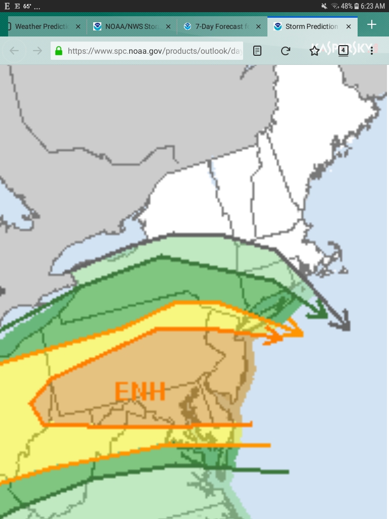
Today, Wednesday 5/29, we can again expect a thunderstorm or two in the afternoon. Like yesterday, these storms could be severe and carry a risk of hail and high winds and a slight risk of a tornado. As yesterday, the risk is higher just to our south, in Union County.
These storms, yesterday and today, are the remnants of the very severe storms that hit the midwest earlier this week.
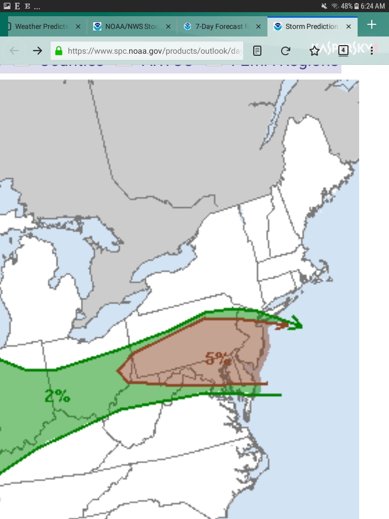
On the maps below, the first map shows the risk of severe thunderstorms this afternoon, the second the risk of a tornado. Note that for MAPSO the tornado risk is 2%, rising to 5% for Union. Also note that the line for enhanced risk on the thunderstorm map runs just south of us, roughly along rt. 78.

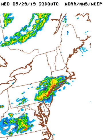
The forecast for early evening today Wed 5/29 looks a lot like the forecast was for last night. There is a tornado watch that extends across PA and runs just south and west of the MAPSO area, just like last night. The models are showing significant activity, this time in a line of storms that should extend from Greenwich Conn to Philadelphia sometime between 5:30 and 8:00pm.
The image posted below is from a model called the HRRR -- this is a short-range (in time) model that runs every hour (the more general models run every 6 or 12) specifically designed for spotting this type of more local weather. The model run initiated at 3:00 this afternoon and is showing strong storms passing over our entire area at 7:00pm tonight.
In another post a little later this afternoon, I will explain a bit about the various types of watches and warnings and what they mean, but the bottom line is a tornado warning means that a tornado is immanent. When you hear a tornado warning, get to shelter, away from doors and windows. Last night there was a tornado in Sussex County, That is 30 miles as the cloud flies from MAPSO. A tornado can cover that distance in 15 minutes.
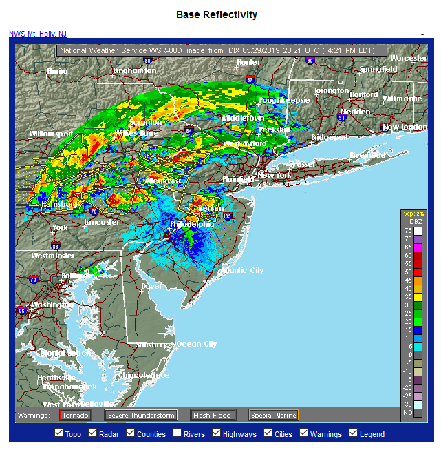
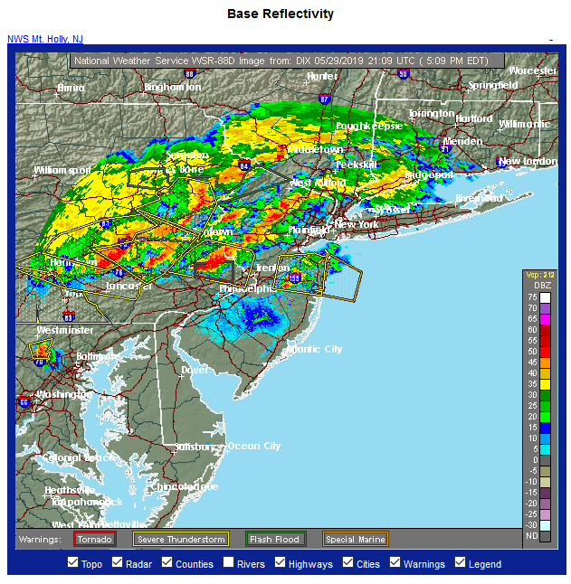
Current Radar. Storms in a line from Harrisburg to West Milford right now, coming our way.
shoot - my mother is with my son in Florham park until 6:30, then home to maplewood... should I have them leave early?
So far the worst of it (that is, the tornado-y part) seems to be heading south of us. There is a warning just west of Philly right now. Fingers crossed.
The warning is the red box on the radar.
lukeysboat said:
shoot - my mother is with my son in Florham park until 6:30, then home to maplewood... should I have them leave early?
How is she driving in the rain in the rain? The first line of storms is coming over Morris County already, so if she leaves now she would be right in front of it, more or less.
Ok, I was more worried about tornadoes, though heavy rain is no good either... thanks - I will let her know....
And thank you for all your forecasting!
Flood Advisory from the NWS for our area:
Flood Advisory
520 PM EDT Wed May 29 2019
The National Weather Service in Upton NY has issued a
* Urban and Small Stream Flood Advisory for...
Hudson County in northeastern New Jersey...
Passaic County in northeastern New Jersey...
Union County in northeastern New Jersey...
Bergen County in northeastern New Jersey...
// Essex County in northeastern New Jersey...//
Southern Westchester County in southeastern New York...
Southeastern Orange County in southeastern New York...
Kings County in southeastern New York...
Rockland County in southeastern New York...
* Until 815 PM EDT.
* At 517 PM EDT, Doppler radar indicated thunderstorms producing torrential rainfall. This will cause urban and small stream
flooding in the advisory area as the rain continues or moves into
the area from the west.
* Some locations that will experience flooding include...
Newark, Jersey City, Paterson, Elizabeth, Passaic, Bayonne, Wayne, Hoboken, Plainfield, Bloomfield, Hackensack, Linden, New City, Orange and Bergenfield.
I am feeling pretty good that this is what we are going to get -- some thunder and lightning, some downpours possible, but it is unlikely we will see anything like last night here at this point. The main body of the storm is well south of us, with lots of lightning and wind in the Philly/Trenton area and east and north to the northern Jersey shore. That will continue much later than we will here, our rain will start tapering off around 7:00 although showers will linger for several hours after that.

Rentals

For Sale


Garage Sales
-

Multi Family Garage Sale Sale Date: Apr 20, 2024
More info


Severe Thunderstorm Warning