SEVERE THUNDERSTORM WARNING June 4 3:10 pm


max_weisenfeld said:
Awesome!
We could see the rotation from here but not like that!
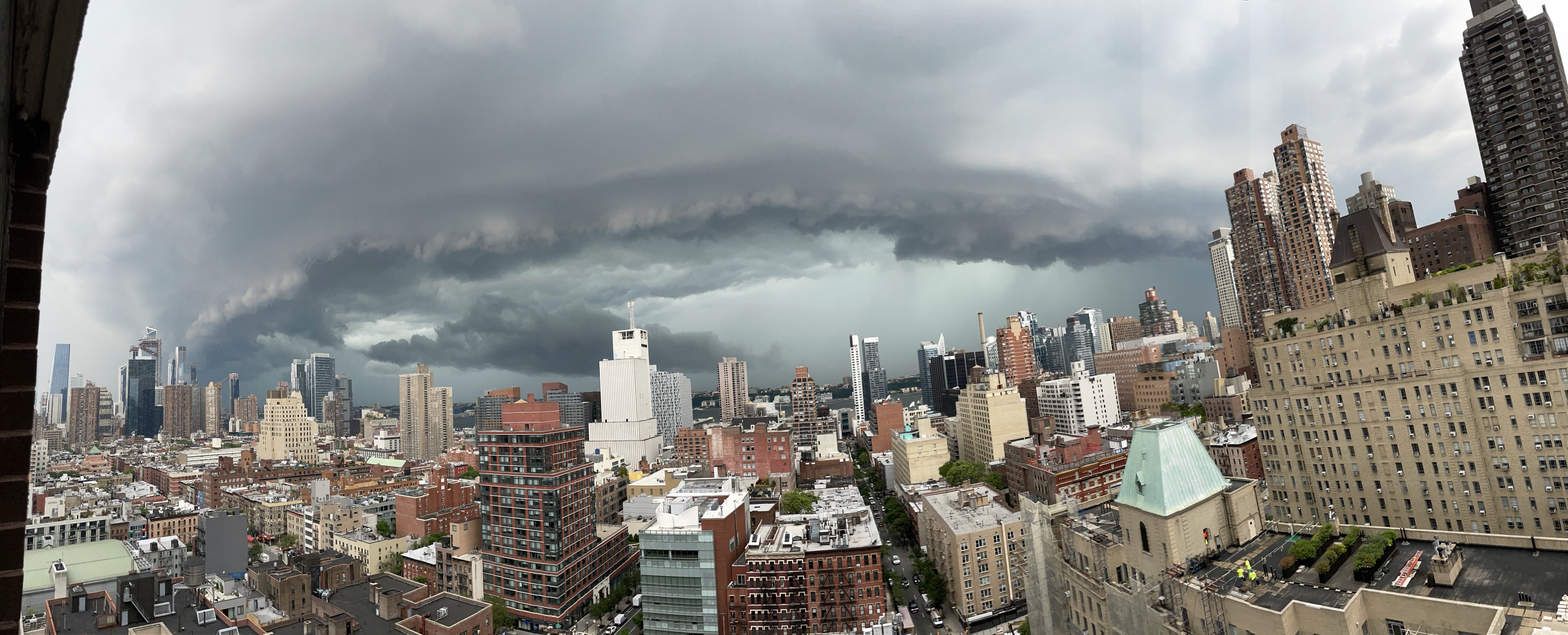
It’s not really rotating here — just the shelf cloud. It started to bow out pretty quickly and lose the supercellular characteristics around Morristown. But two very legit mesocyclones in this radar grab.


WxNut2.0 said:
Knew this west facing apartment would finally pay off
Wow! Amazing pic!

In order to add a comment – you must Join this community – Click here to do so.


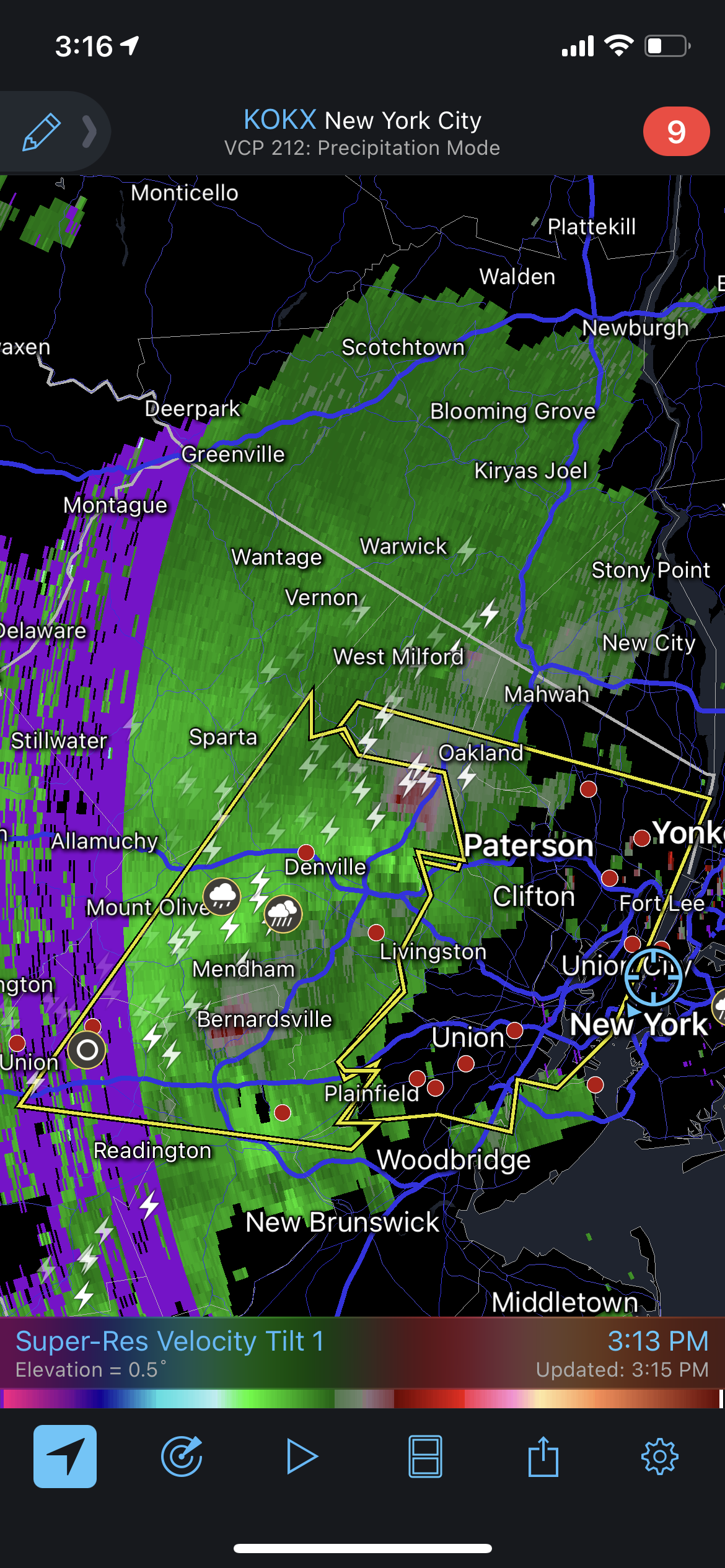
The NWS has issued a SEVERE THUNDERSTORM WARNING
The system is now reaching severe levels. The most likely impacts are WIND GUSTS OF 60 MPH and Penny Sized Hail
ETA MAPSO 3:50pm
Severe Thunderstorm Warning
Severe Thunderstorm
The National Weather Service in Upton NY has issued a
* Severe Thunderstorm Warning for... Hudson County in northeastern New Jersey... Central Passaic County in northeastern New Jersey... Union County in northeastern New Jersey... Bergen County in northeastern New Jersey... Essex County in northeastern New Jersey...
* Until 400 PM EDT.
* At 309 PM EDT, severe thunderstorms were located along a line extending from Bloomingdale to near Peapack And Gladstone, moving east at 30 mph.
HAZARD...60 mph wind gusts and penny size hail.
SOURCE...Radar indicated.
IMPACT...Expect damage to trees and power lines.
* Severe thunderstorms will be near... Pompton Lakes and Bloomingdale around 315 PM EDT. Wayne around 320 PM EDT. Paterson and Hawthorne around 330 PM EDT. Ridgewood around 335 PM EDT. Plainfield and Paramus around 340 PM EDT. Bergenfield and Summit around 345 PM EDT. Englewood and Clark around 350 PM EDT. Union around 355 PM EDT. Newark and Elizabeth around 400 PM EDT.
PRECAUTIONARY/PREPAREDNESS ACTIONS...
For your protection move to an interior room on the lowest floor of abuilding.